Glaciolacustrine clays and silts define much of Prince George's subsurface, deposited by ancient glacial lakes that once filled the Fraser-Nechako basin. These fine-grained soils can stand almost vertical in a fresh cut, but exposure to air and moisture triggers rapid slaking and progressive raveling within hours. We see this pattern repeat across downtown sites and along the Highway 16 corridor. Our monitoring approach directly addresses the time-dependent behavior of these sensitive sediments. We install automated telltales, inclinometers, and piezometers to track deformation and pore pressure from day one of bulk excavation. For deeper cuts near the Nechako River, where groundwater sits within 3 to 5 meters of surface, we often combine real-time vibration monitoring with a liquefaction assessment to rule out cyclic softening in saturated silts during compaction activities. The 53.9°N latitude brings freeze-thaw cycles from October through April that can alter shoring loads, so we maintain continuous data logging through the full construction season.
Sensitive glaciolacustrine clays in Prince George can lose 60% of their peak strength within 48 hours of unsupported exposure—monitoring closes the gap between excavation and permanent structure.
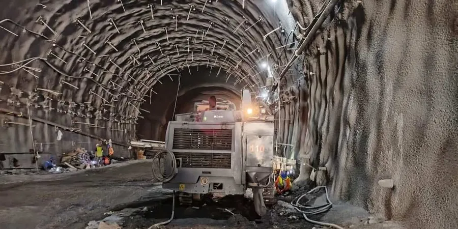
Methodology applied in Prince George
Typical technical challenges in Prince George
Prince George's expansion from a fur-trading post to a regional supply hub left a patchwork of undocumented fill across the downtown bowl. Old sawmill foundations, buried log decks, and backfilled creek channels appear without warning once excavation reaches 2 or 3 meters. These materials settle unevenly and can concentrate lateral loads on shoring where you least expect them. We have tracked wall deflections that doubled overnight after a heavy rain saturated a pocket of uncompacted wood waste behind the lagging. River-adjacent sites add a second layer of risk: the Nechako's seasonal fluctuation shifts pore pressure regimes enough to reverse hydraulic gradients, pulling fine particles through drainage systems. Instrumentation that only records once a week misses these transient events entirely. Our continuous monitoring catches the inflection point before a slow creep becomes a sudden movement, giving the site team a window to adjust tieback tension or install additional bracing.
Our services
Our monitoring scope in Prince George covers everything from single-family basement cuts in College Heights to multi-level parkades downtown. We design the instrumentation layout, supply and install all sensors, and manage data through a secure online portal that the contractor, geotechnical engineer, and owner can access simultaneously.
Automated Excavation Monitoring
Continuous inclinometer, piezometer, and crack gauge networks with SMS and email alerts. We handle sensor installation, baseline calibration, and weekly interpretive reports that compare measured deflections against NBCC 2020 limits.
Vibration and Settlement Surveys
Triaxial geophone monitoring for blasting and compaction, plus optical survey arrays on adjacent structures. We deliver daily PPV summaries and cumulative settlement plots, with immediate notification if vibration exceeds the 12 mm/s threshold at occupied buildings.
Frequently asked questions
What is the cost range for excavation monitoring in Prince George?
Monitoring programs in Prince George typically fall between CA$970 and CA$3,030 depending on the number of instruments, the duration of the monitoring period, and the complexity of the site. A basic setup with one inclinometer string, two piezometers, and monthly manual surveys runs at the lower end, while a full automated array with multiple sensors, cloud dashboard access, and weekly reporting reaches the upper range. We provide a fixed-price quote after reviewing the shoring design and site constraints.
How is monitoring data shared with the project team?
All sensor data feeds into a cloud-based platform that displays real-time graphs of deflection, pore pressure, and vibration. Project members receive login credentials with role-based access—the superintendent might only need the alert dashboard, while the geotechnical engineer sees raw data exports. We also compile weekly PDF reports that flag any exceedance of pre-set thresholds and include our interpretation of the observed trends.
What triggers an automatic alert during monitoring?
We program two alert levels: a warning threshold and an action threshold. A typical warning threshold is lateral wall deflection reaching 70% of the design limit, which sends an email notification. The action threshold—usually 0.5% of retained height or a sudden 3 mm movement in one hour—triggers SMS messages and phone calls to the designated site contacts. Vibration alerts fire if peak particle velocity exceeds 12 mm/s at the nearest occupied building.
Can you monitor existing buildings adjacent to the excavation?
Yes, building monitoring is a standard part of our scope. We install optical prisms on exterior walls and crack gauges across existing fractures, then survey these targets from a stable benchmark outside the zone of influence. This gives us independent displacement data that we cross-reference with inclinometer readings behind the shoring wall. In Prince George, many older concrete block buildings along 3rd Avenue are particularly sensitive to differential settlement.
Do freeze-thaw cycles affect the monitoring instruments?
All sensors we install in Prince George are rated for winter conditions. Vibrating wire piezometers include built-in thermistors for temperature compensation, and inclinometer casings are grouted below the frost penetration depth—typically 1.5 meters in this region. The data loggers sit inside weatherproof enclosures with battery backup, and we switch to cold-weather calibration factors between October and April to maintain accuracy despite temperature swings.