A common misstep we see on Prince George hillside projects is treating a slope stability analysis as a simple desktop exercise without reconciling the site-specific stratigraphy. The valley walls along the Nechako and Fraser rivers are underlain by up to 30 meters of glaciolacustrine silts and clays, often interbedded with sand seams that act as perched aquifers. When a cut is opened for a foundation or a roadway realignment near University Heights, these water-bearing lenses can trigger progressive slumping within days, even on slopes as gentle as 4H:1V. Our work integrates subsurface data from spt-drilling to define the shear strength profile and identify critical weak layers before the limit equilibrium model is built, ensuring the factor of safety reflects actual in-situ conditions rather than assumed textbook parameters.
A slope stability model is only as reliable as the pore pressure assumptions behind it, and in Prince George those assumptions must account for the perched groundwater that the regional till stratigraphy conceals.
Methodology applied in Prince George
Typical technical challenges in Prince George
A 14-unit townhouse excavation on a 22-degree slope above the Fraser River encountered a laminated silt layer with a pre-sheared fabric at 6 meters depth, likely a relict failure plane from post-glacial valley rebound. The initial design, which assumed a homogeneous clay with a friction angle of 28 degrees, returned a factor of safety of 1.6. After the shear zone was identified through continuous sampling and the residual strength envelope was applied, the recalculated FoS dropped to 0.95 under the saturated spring conditions. The remediation required a row of soldier piles socketed into the underlying lodgement till, combined with horizontal drains to depressurize the sand seam feeding the shear zone. Without the site-specific investigation, the excavation would have proceeded with a false sense of security. Prince George's post-glacial history, with the incision of the Fraser and Nechako rivers through the lacustrine plain, has left a legacy of dormant slip surfaces that must be actively sought out during any stability assessment.
Our services
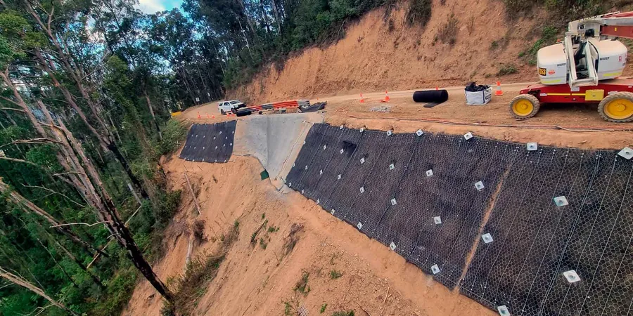
Our Prince George slope stability investigations are structured to deliver a defensible factor of safety and a remediation concept that can be priced by local contractors without excessive contingencies.
Limit Equilibrium Slope Stability Analysis
Two-dimensional modelling using Spencer or Morgenstern-Price methods, with shear strength inputs from triaxial CIU tests on undisturbed samples. The analysis covers static, rapid drawdown, and pseudo-static seismic conditions in accordance with NBCC 2020 for the Prince George seismic hazard level.
Remediation Design and Construction Oversight
Design of soldier pile walls, soil nail arrays, horizontal drain networks, and regrading schemes for failing cut slopes in the glaciolacustrine deposits of the Fraser-Nechako corridor. Includes full-time field supervision during excavation to verify stratigraphy against the design model.
Frequently asked questions
What triggers slope instability in the Prince George area?
The most common trigger is elevated pore water pressure in sand and silt seams within the glaciolacustrine deposits. During the spring freshet on the Nechako and Fraser rivers, the water table rises rapidly while the river stage drops, creating a hydraulic gradient that can initiate shallow slumping. Excavation at the toe of a slope without adequate dewatering is the most frequent human cause.
How much does a slope stability analysis cost for a single-family lot on a hillside?
For a typical hillside lot in the Cranbrook Hill or University Heights area, the scope usually includes a drill rig mobilization, two to three boreholes with SPT testing and Shelby tube sampling, installation of a standpipe piezometer, and the limit equilibrium analysis. The cost ranges from CA$1,780 to CA$5,350 depending on access constraints and the number of stratigraphic units that need to be characterized.
How long does a stability investigation take from start to finish?
Fieldwork typically requires three to five days for drilling and sampling, plus an additional two weeks for triaxial testing on the recovered samples. The analysis and report, including the limit equilibrium modelling and remediation recommendations, are delivered within four weeks of the field program completion, assuming no significant weather delays.
Do you need to monitor the slope after remediation?
Yes, for permanent cuts exceeding 6 meters or slopes supporting occupied structures, we specify a monitoring program with inclinometers and vibrating wire piezometers. Readings are taken monthly for the first year and quarterly thereafter, with trigger thresholds for movement rate and pore pressure that, if exceeded, prompt a reassessment of the drainage or structural measures in place.